This map shows Union Forces (Blue Square, Center/Top) stationed on Samuel Miller’s land – roughly on the same piece of land that he would later donate for a Brethren Church and cemetery. Confederate forces are shown in red just across the North River from Bridgewater (to the South-West). Samuel’s house is marked on this map as well – it is the closest small black square north-east of (Behind, right/diagonally right) the Union line. This battle occurred on October 4th and 5th, 1864.
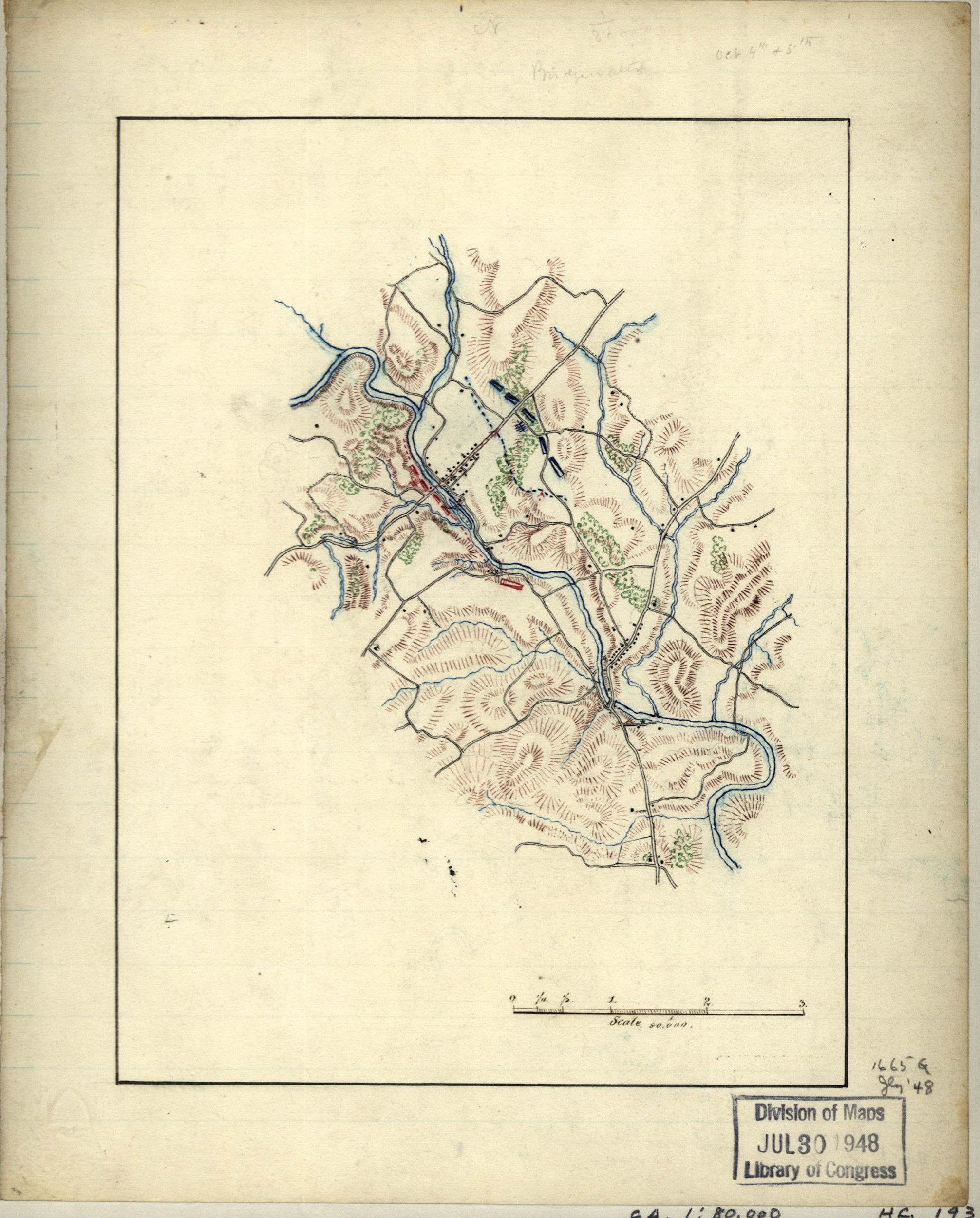
Hotchkiss Map of the Cavalry Engagement Near Bridgewater VA., Oct. 4th & 5th, 1864
The original file and additional information on the location of the hard-copy and other citation information are available at the following link:
Library of Congress Page with Citation and Original File Link
Full Citation: Hotchkiss, Jedediah. Map of Cavalry Engagement Near Bridgewater, VA., on Oct. 4th and 5th. 1864, Library of Congress Geography and Map Division, Washington, D.C., Map. https://www.loc.gov/item/2005625100/.