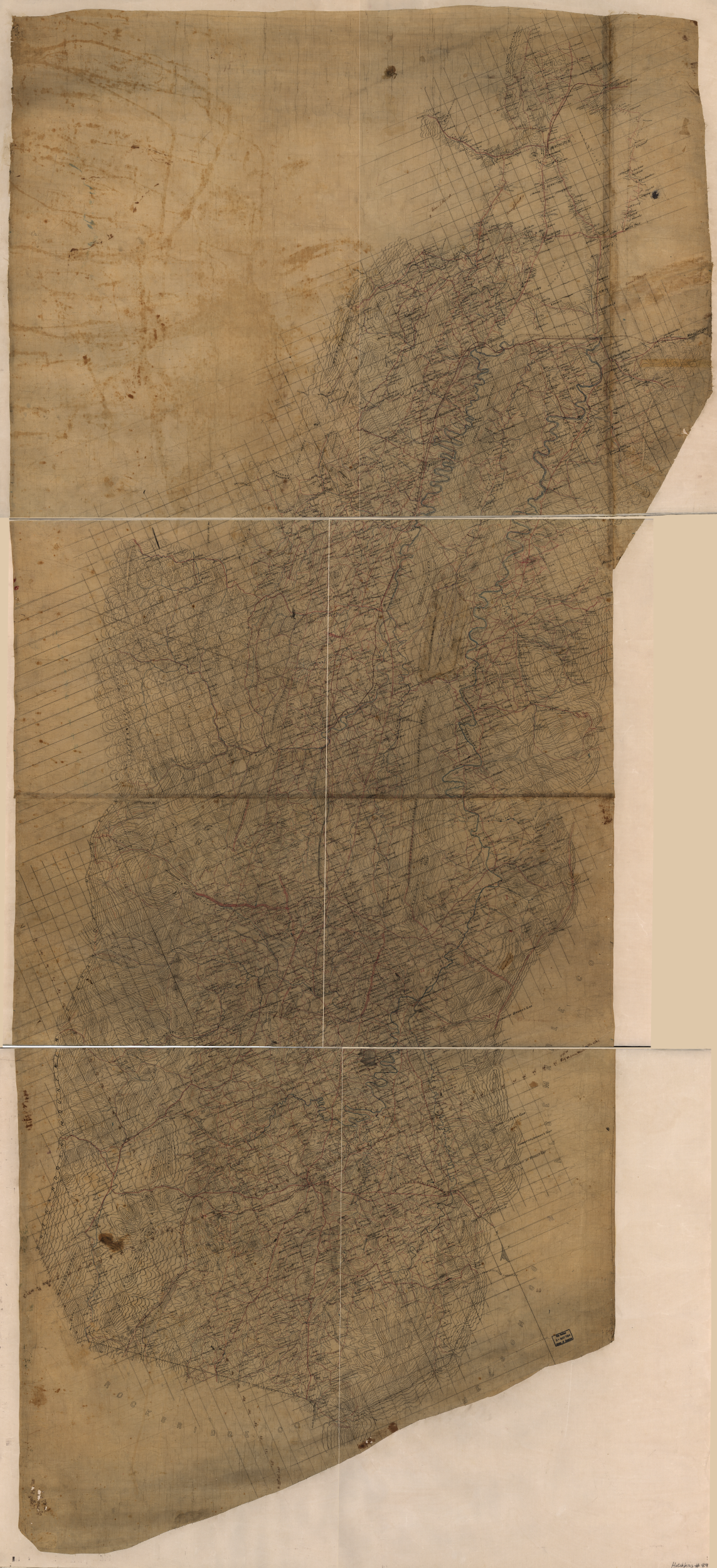
This map is absolutely massive. The original canvas map is roughly 8.34′ tall x 3.67′ wide (note that the measurements are in feet). The .tiff file from the Library of Congress page is roughly 900mb and has been divided into individual panels below to make downloading less cumbersome. Please consult to Library of congress page below for the original file.
Library of Congress Page with Citation and Original File Link
Download Links for Individual Panels
These .tiff files are reduced, though still readable. Given the size of the full-size .tiff file from the Library of Congress page, each panel has been broken out here for convenience.
Hotchkiss Map of the Shenandoah, Panel 1 (Top Left, Areas West & Southwest of Winchester)
Hotchkiss Map of the Shenandoah, Panel 2 (Top Right, Winchester & Areas East, South East)
Hotchkiss Map of the Shenandoah, Panel 3 (Center Left, Bridgewater & Areas West)
Hotchkiss Map of the Shenandoah, Panel 4 (Center Right, Areas east of Bridgewater)
Hotchkiss Map of the Shenandoah, Panel 5 (Bottom Left, Staunton)
Hotchkiss Map of the Shenandoah, Panel 6 (Bottom Right, Waynesboro)
Full Citation: Hotchkiss, Jedediah, Map of the Shenandoah Valley, 1862, Library of Congress Geography and Map Division, Washington, D.C., Map. https://www.loc.gov/item/99446754/.